Photogrammetry is the process of making measurements of three-dimensional objects and terrain features with two-dimensional photographs. Applications include the measuring of coordinates; the quantification of distances, heights, areas, and volumes; the preparation of topographic maps; and the generation of digital elevation models and orthophotographs.
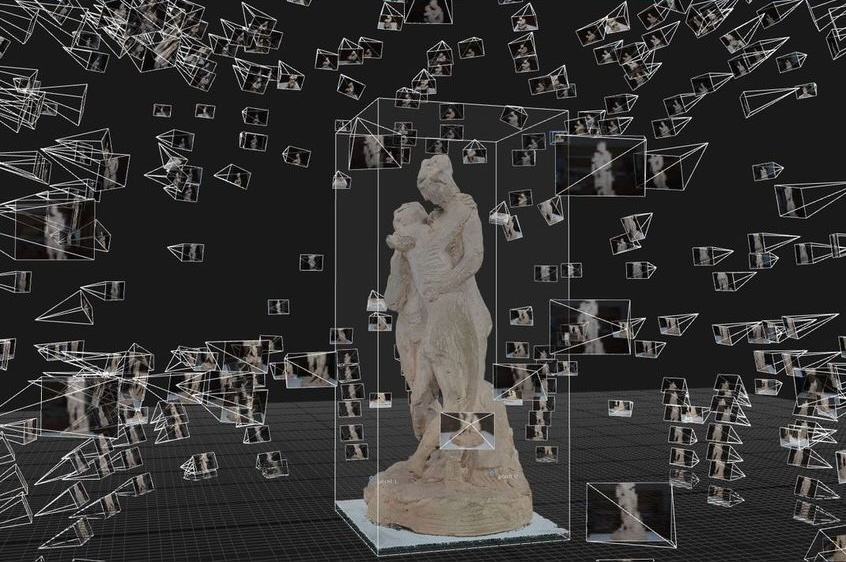
Photogrammetry capture - points cloud
3D Rendering is achieved by combining multiple images taken from different directions to create a 3D model of a scene. The resulting point cloud is a collection of points in 3D space, each with its own set of attributes such as color, normal, and texture coordinates. This technique allows for the creation of detailed 3D models, making it a powerful tool to capture and display realistic artifacts.
Principles of Photogrammetry
Photogrammetry is based on the principle of triangulation, where multiple images of the same object or scene are taken from different angles. By analyzing the overlapping areas between these images, photogrammetry software can calculate the 3D coordinates of the object or scene, creating a point cloud. This point cloud can then be used to generate a 3D model, which can be textured and further refined.
Types of Photogrammetry
Is typically classified into two categories.
-
Aerial Photogrammetry Aerial photogrammetry involves taking images from an aerial platform, such as a drone or an airplane. This type of photogrammetry is useful for capturing large areas and creating high density/resolution 3D models.
-
Terrestrial Photogrammetry Terrestrial photogrammetry involves taking images from the ground, either handheld, a tripod or a ramp. This type of photogrammetry is useful for capturing small to medium-sized objects.
The domain is also sub categorised as follows:
a. Close-Range Photogrammetry Deals with object distances up to 200 meters. Capturing small to medium-sized objects or scenes.
b. Small-Format Aerial Photogrammetry Combines the aerial vantage point with close object distances and high image detail. Capturing small to medium-sized areas with high resolution.
Workflow
Typically:
- Image acquisition: Taking high-quality images with sufficient overlap and coverage.
- Image processing: Using specialized software to process the images and create a point cloud.
- Point cloud refinement: Refining the point cloud to remove noise and improve accuracy.
Further Sections:
- Camera Calibration: A guide to calibrating cameras for photogrammetry, including the importance of camera calibration and how to perform it.
- Image Acquisition Techniques: A guide to image acquisition techniques, including tips for capturing high-quality images and minimizing noise/error.
- Point Cloud Processing: A guide to point cloud processing, including techniques for refining and editing point clouds.